Upper Mustang Trek (Lo-Manthang)

based on 3 reviews
Upper Mustang Trek (Lo-Manthang)
At a Glance
  • Trip Duration17 Days
  • Destination Nepal
  • Trip Grade Moderate
  • Max. Altitude 3,810 meters (Lo-Manthang)
  • Starts at Pokhara
  • Ends at Jomsom
  • Group Size 1-20
  • Activities Trekking
  • Best Time Spring (March-May) Autumn (Sept-November)
Highlights
  • Upper Mustang Lo-Manthang Trek
  • Explore the ancient Kingdom of Lo-Manthang
  • Trek in Unique Varieties of Landscape and Un-touch Caves
  • Rich in Tibetan culture and unspoiled nature
  • Visit Mysterious Jhong Cave
  • A great trek to escape the monsoon as well as summer
  • Kingdom behind the Dhaulagiri 8167m and Annapurna 8167m Range Himalaya  

Upper Mustang Trek has highly preserved Tibetan culture and unspoiled nature.  The upper Mustang is called the kingdom behind the Himalayas. Trek has unique varieties of Landscapes and Geographics. Mustang (from Tibetan Mun Tan (Wylie smon-thang) which means fertile plain) is the former Kingdom of Lo and now part of Nepal, in the north-central part of that country, bordering Tibet on the Central Asian plateau between the Nepalese provinces ofDolpo and Manang. The Kingdom of Lo, the traditional Mustang region, and "Upper Mustang" are the same, comprising the northern two-thirds of the present-day Nepalese Mustang District, and are well marked by official "Mustang" border signs just north of Kagbeni where a police post checks permits for non-Nepalese seeking to enter the region, and at Gyu La (pass) east of Kagbeni. Mustangis people follow Tibetan Buddhism as well.
 
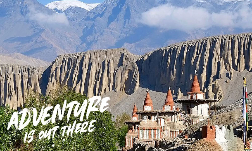
Upper Mustang trekking is located north of Annapurna Region and at an average altitude of 4,000m is geologically and culturally part of the Tibetan plateau. The valleys are arid with colorful rock formations containing many cave dwellings high up in the cliffs. The first trekking parties were allowed into Upper Mustang in 1992 and there are still very few people (about 700 trekkers each year) visiting Upper Mustang as a result it is one of the few places left where one can see undisturbed Tibetan culture. The Land Upper Mustang is also known as the Kingdom of Horse as well as Buddhist Monasteries
 
Lo, like Dolpo, has a rich and complex history, with written records dating back to the 8th century. It was once part of the western Tibetan region of Ngari and maintained its status as a separate principality until 1951.
 
It is a land of barley fields and pasture and vast expanses of gray and yellow rolling hills eroded by the wind that howls across the area most afternoons. Sun-baked bricks of pale mud are used for almost all construction, including the walls and palace of Manthang

A1 Excursion Adventure offers you 17 days of Upper Mustang Trekking. A1 Excursion Adventure always believes in providing excellent service with a tailor-made trip for you with a popular route map and trek itinerary as well as cost details. We, A1 Excursion Adventure look forward to guiding you to the popular Upper Mustang trekking for a lifetime memory.

Itinerary
Expand AllCollapse All

We will welcome you at Tribhuvan International Airport upon your arrival and transfer you to the hotel for the overnight stay.

  • Accommodation:Hotel

BOUDHANATH STUPA: lies about 6 km east of downtown Kathmandu and is the largest stupa in the Valley and one of the largest in the world. It looms 36 meters high and presents one of the most fascinating specimens of stupa design with hundreds of prayer wheels and 108 small images of Buddha all around. Just like the Swayambhunath, the stupa here is too has four sides with the watchful eyes of Lord Buddha. All the Buddhist throng to this stupa to take part in the sacred rituals during the Buddhist festivals. The area of the stupa boasts of more than 35 gompas and is easily accessible by being a short walking distance from Pashupatinath and a little north to the airport. The Losar, the Tibetan New Year Day coming around in the months of February or March, is grandly celebrated as the biggest festival here. Therefore, a massive crowd of tourists can be seen swarming the place during such days.

PASHUPATINATH TEMPLE: One of the most sacred Hindu shrines in the world, Pashupatinath lies 5 km east from the city center. The richly-ornamented pagoda houses the sacred linga, or phallic symbol, of Lord Shiva as well as the noteworthy gold plated roofs and silver coated doors. This is the abode of God Shiva and is the holiest of all the Shiva shrines.Religious pilgrims and sadhus, like the one pictured here, travel all the way from the remote areas of India to visit this sacred sight, especially during Shivaratri (the night of Shiva) that falls between February/March. Even though these devotees have denounced worldly possessions, each carries a Sadhu ID (identifications card) to freely cross over the border between India and Nepal.Chronicles indicate Pashupatinath’s existence prior to 400 AD. Devotees can be seen taking ritual dips in the holy Bagmati river flowing beside the temple, also a World Heritage Site. 
 

  • Accommodation:Hotel

After having breakfast in the morning today, we drive to Pokhara. It takes around 7 hours to reach Pokhara from Kathmandu by bus. You can also take the flight which take about 30 minutes and in the remaining time, take your time to explore the Pokhara city and Lakeside. We stay overnight at a guesthouse in Pokhara.

  • Trip Duration:7 hrs
  • Accommodation:Hotel

Our guide assists you to transfer for Pokhara Airport to fly for Jomsom. This scenic adventurous flight takes about 20-25 minutes passing through the world’s deepest George presenting spectacular mountain views of Mt. Dhaulagiri, Annapurna Ranges and Fishtail with several famous peaks within the Annapurna and Dhaulagiri area from its both sides. The airstrip is in Jomsom, the main village in the Kali Gandaki valley. Jomsom is the beginning point of our trek. After landing here we start our trek toward Kagbeni which takes about 3-4 hours walk. Kagbeni is also the check point for entrance to restricted Upper Mustang Trekking. We can enjoy the majestic view of Mt. Dhaulagiri, Nilgiri and Tukuche peak while walking the trail in the opposite direction. Your overnight accommodation is set here in tented camp/tea house/Lodge

  • Max. Altitude:2,810 m
  • Trip Duration:4hrs
  • Accommodation:Tea House

After the formalities of showing your restricted area trekking permit in Kagbeni we start our trekking early because in Mustang there is heavy wind which gets up later in the day, blowing dust and sand around. In the route we can see Nilgiri glowing orange in the first rays of the sun. We take the western route, following the east bank of the river until we reach the end of a broad valley Chuksang, where we cross the Kali Gandaki. After Kagbeni, the trail climbs up, giving us a good view of the village, the valley and Nilgiri. At first the path follows the river closely and later it leads eastwards to flat, dry, desert-like land. Here the scenery is amazing and very characteristic of Mustang with red sandstone pillars and rock formations with fantastic forms and colors, formed by thousands of years of erosion. The first main village we reach, Tangbe, has red and whitewashed houses and on the other side of the river from here are caves, perched high in a vertical wall, which were believed as habitations in previous times. Chaile appears as a small white dot at the end of the canyon. The trail towards here descends gradually to the river-bed – this area is well-known for its fossils. The wide valley ends abruptly at a vertical cliff and a bridge crosses the Kali Gandaki, which flows through a natural tunnel in the cliff. The valley narrows further north and a steep trail leads us up to Chaile, which is a small town with good views towards the Himalayan ranges. Our tented camp or tea house accommodation is set here in Chaile for today.

  • Max. Altitude:3,050 m
  • Trip Duration:6hrs
  • Accommodation:Tea House

  • Max. Altitude:3,570 m
  • Trip Duration:6hrs
  • Accommodation:Tea House

  • Max. Altitude:3,560m
  • Trip Duration:6 hrs
  • Accommodation:Tea House

Today’s trekking begins on flat terrain and the view, apart from a chorten and a few caves, is unrelieved barrenness. After crossing a pass and waking through two rocks forming a natural gate we have finally arrived at Lo Manthang.
 

  • Max. Altitude:3,810 m
  • Trip Duration:5-6 hrs
  • Accommodation:Tea House

The city contains about 150 houses, as well as residences for its many lamas. There are four major temples within the city and one of these, Champa Lhakang, contains a huge clay statue of Buddha as well as elaborates mandalas painted on the walls. The king's palace is an imposing building in the center of the city and is occupied by the current King and Queen. Although his duties are largely ceremonial, the King is respected by the people and consulted about many issues by villagers throughout the kingdom.

  • Max. Altitude:3,810m
  • Accommodation:Tea House

You continue your journey on the highland route, crossing alpine meadows before dropping down a steep eroded alley to Dhakmar for lunch. After lunch, you walk through the pretty valley, climb to a ridge and descend from there back to Ghimi.
 

  • Max. Altitude:3,520 m
  • Trip Duration:7hrs
  • Accommodation:Tea House

Leaving Ghimi you begin to follow a narrow winding path until you reach Geling, crossing a small stream. Samar is a small village with terraces, Tibetan style houses, mani walls, a monastery, prayer flags and people following Tibetan life styles and traditions. Stay overnight.

  • Max. Altitude:3,660 m
  • Trip Duration:6hrs
  • Accommodation:Tea House

Following a descending path you reach Chuksang by crossing a suspension bridge over Kali Gandaki. You walk along the bank of Kali Gandaki with views of natural vegetation and apple orchards. Stay overnight.
5

  • Max. Altitude:2,810 m
  • Trip Duration:5-6 hrs
  • Accommodation:Tea House

We make a steep climb up the Jhong Khola valley leaving Kagbeni, we then join the direct trail to Muktinath just below Khingar at 3,200m. From here trail continues high above the Jhong Khola to the imposing village of Jharkot at 3,500m. well worth exploring. As we leave Jharkot, the trail climbs up to our ultimate destination of Muktinath at 3,802m. We initially visit Ranipauwa, there are many teahouses and shops. Further 10 minutes walks up the hill, we will be rewarded with the actual religious site of Muktinath. Muktinath is a pilgrimage center for Buddhists and Hindus. Holy water flows from the 108 carved spouts surrounding the Vishnu temple in a grove of poplars. There are shrines in a grove of trees including a Buddhists Gompa & the Vishnu temple of Jwalamai. An old temple nearby shelters a spring and natural gas jets that provides Muktinath’s famous eternal flame. It’s the earth-water- fire combination that accounts for Muktinath’s great religious significance. Overnight stay at a hotel.

  • Max. Altitude:3,760 m
  • Trip Duration:4 hrs
  • Accommodation:Tea House

As we begin the final day’s hiking, Dhaulagiri glows orange and the yellow in the early morning sun. Today we take a side trip to the Bon Punt soling monastery in Lubra, before returning to Jomsom for the flight back to Pokhara. The trail is rather sporadic. From a small hill the views of Muktinath are good and it is plain that much of the valley is used for agriculture. We soon reach the Panga Khola valley and the track follows the course of the river, but high upstream. We have to cross the river and walk downstream on the other side, which seems like a major detour but is necessitated by the steep cliffs further down.
After a steep ascent and descent we come to an area of pine forest – a surprising change of scenery! We are high above the river again and must cross two bigger side-valleys on the way downstream. Eventually we come to some fenced-in fields and a garden with apple trees, near Lubra’s village school. The settlement of Lubra consists of about 20 houses near a bend in the river and was founded in connection with the establishment of the Bon Punt soling monastery in the 12th century. This is one of the very few Bon monasteries remaining in Nepal. Bon was the predominant religion in Tibet before the spread of Buddhism and is also called the fifth tradition of Tibetan Buddhism. In the monastery are pictures of four Lokapalas and Buddha Shakyamuni. Bags of masks hang from the ceiling. It is still the tradition today that the head member of Lubra’s nine major families automatically becomes a priest.
After Lubra, the trail leads to the Kali Gandaki and we have to leap across the river Panga a couple of times! At the confluence of the two rivers we join the caravan of tourists going to Jomsom.

  • Max. Altitude:2,720 m
  • Trip Duration:5hrs
  • Accommodation:Tea House

We take early morning 20min flight from Jomsom to Pokhara; we transfer you to the Hotel there in Bb Plan. The day we give you chance for exploring the beautiful valley Pokhara with its Natural and cultural beauty.

  • Max. Altitude:822 m
  • Trip Duration:25 minutes
  • Accommodation:Hotel

We drive back to Kathmandu from Pokhara today. Upon reaching Kathmandu, you can utilize your time for the last minute shopping or you can explore around the city. We celebrate the Farewell Dinner together with the trekking team and spend overnight at the hotel.

  • Max. Altitude:1,400 m
  • Accommodation:Hotel

We are saying good bye to the Kathmandu as your journey in Nepal comes to an end today! We will transfer you to the airport for your returning flight.

    Trip Map
    Upper Mustang Trek (Lo-Manthang) map
    Cost Includes
    • Airport to hotel transfer by private vehicle Domestic and International
    • 3 night’s hotel accommodation in Kathmandu on BB plan
    • 2 nights’ hotel accommodation in Pokhara on BB Plan. 

    While in Trekking:

    • Basic Accommodation of Lodges and guesthouses on a sharing basis during the trek.
    • 3-time meals a day (Breakfast, Lunch, and Dinner) at the time of Trekking with a cup of tea or coffee
    • The Upper Mustang restricted special area permit fee is $500 per person for 10 days. More than 10 days cost $ 50 each day.
    • Annapurna Conservation Area Permit (ACAP permit)
    • TIMS Card (Trekking Information Management System) for the trek.
    • All Necessary Equipment (like A1 Sleeping bag, A1 down jackets, Inner liner, and A1 duffel Bag all returnable)
    • An experienced Trekking Guide trained and certified by NATHM (Nepal Academy of Tourism and Hotel Management) and an experienced Porter (1 porter: 2 clients Basis)
    • All staff necessities: all meals, Equipment, accommodation, Insurance, medical salary, expenses, field allowance, etc.
    • All ground Transportation from Kathmandu – to Pokhara, in return drive from to Kathmandu (all Private Vehicle)
    • Domestic flight from Pokhara-Jomsom-Jomsom-Pokhara
    • First Aid Kid Box( Primary Health Treatment only)
    • All government and non-government service taxes


    Cost Excludes
    • Nepalese visa fee.
    • Travel insurance.
    • Rescue charge
    • Personal Equipment and Expenses (alcoholic beverages, mineral water, phone calls, internet, laundry, bar bills, battery recharge, extra porters, boiled water, shower, etc.)
    • Extra service: Horse riding / Jeep rides / Helicopter
    • Tips, Donations


    Useful Information

    If the group size is above 12 pax then the leader will be FOC except the Trekking Permit taxes and fight ticket.

    WHAT TO BRING

    Trekking/Hiking Gears (Equipment)

    Clothing and Wears

    • Trekking shoes with spare laces
    • hiking boots (waterproof is better)
    • Gore-Tex pants 
    • Long shorts
    • Sun hat 
    • Jumper
    • Waterproof Jackets 
    • A1 Down Jacket (Returnable)
    • Fleece Jacket
    • Fleece cap
    • Thermal Long Underwear Sets 
    • Neck Gaiter
    • Gloves
    • Socks 
    • Thermal Underwear
    • Sandals

    Essential Gears

    • A1 Duffel or Rucksack bag (If do not have then Duffel Bag Provided Returnable)
    • A1 Down Sleeping Bag (Provided Returnable)
    • A1 Inner Liner (Provided Returnable)
    • Trekking Poles 

    Gadgets

    • Map
    • Compass
    • Mobile        
    • Camera
    • GPS 
    • Two-way radios
    • Binoculars
    • Head Lamp
    • Flashlight

    Sun Protection Items

    • Sunglasses
    • sunscreen
    • Lip balm

    Medical

    • First-aid Kit (Brufen, Antibiotic, Diamox, Paracetamol, Handy Plaster, Crack Bandage, Tincture, Iodine, etc.).

    Other Essentials

    • Heat/Leak Proof water bottles
    • Water Purifying solution (Iodine based)
    • Water filters
    • Insulated cup/flask
    • Travel Documents
    • Cash
    • Extra batteries
    • Power bank
    • Reusable (spoon, cup, plate)
    • Reusable bags
    • Large Waterproof Disposable Bags
    • Snacks
    • Toiletries 
    • Personal towel
    FAQs
    • The Upper Mustang trek is considered moderately difficult, with the main challenges being the high altitude and the rugged terrain. The trek crosses several high mountain passes, which can be strenuous. However, the stunning landscapes and unique cultural experiences make it a rewarding and unforgettable adventure.

    • The length of the Upper Mustang trek can vary depending on the starting and ending points. Generally, the trek takes around 10 to 16 days to complete, covering a distance of approximately 120 kilometers. However, you can choose to extend or shorten their trek based on your preferences and physical abilities.

    • The Upper Mustang trek price varies depending on various factors, such as the duration of the trek, mode of transportation, accommodation, permits, and guide fees. On average, a trek to Upper Mustang can cost anywhere between USD 1,500 to USD 2,500 per person.

    • The best time to visit Upper Mustang is from March to May and from September to November. During these months, the weather is generally dry, with clear skies and comfortable temperatures. Likewise, you can also do this trek in the monsoon (June to August).

    • Upper Mustang is relatively expensive due to its remote location, limited accessibility, and restricted area permit. The permit alone cost USD 500 for 10 days, which is significantly higher than other trekking regions in Nepal. Additionally, the cost of transportation, accommodation, and food in Upper Mustang is higher due to its remote location and limited availability of resources.

    • Upper Mustang is a restricted area due to its location near the Tibetan border and its historical and cultural significance. In the past, Upper Mustang was also a strategic trade route between Nepal and Tibet. To preserve the unique cultural and natural resources of the region, the Nepalese government has restricted the number of visitors and implemented a special permit system for foreigners.

    • Upper Mustang is famous for its unique cultural heritage, stunning landscapes, and remote location. The region has a distinct Tibetan Buddhist culture and architecture that is well-preserved due to its restricted access.

    • Yes, hiring a guide is mandatory for trekking in Upper Mustang. The Nepalese government requires all foreign visitors to be accompanied by a licensed guide and obtain a special permit to enter the region.

    • It is recommended to dress in layers while trekking in Mustang, as the weather can be unpredictable, and temperatures can fluctuate throughout the day. Trekkers should wear a comfortable and breathable base layer, a warm mid-layer, and a waterproof and windproof outer layer.

    • Yes, there is snowfall in Upper Mustang during the winter months of December to February. The region experiences a cold and dry climate, and the temperatures can drop below freezing at night.

    • Lower Mustang and Upper Mustang are two distinct regions in Nepal that differ in terms of geography, culture, and accessibility. Lower Mustang is a subtropical region located at a lower elevation and is easily accessible by road. Upper Mustang, on the other hand, is a high-altitude desert region that is located in the rain shadow of the Himalayas. It is a restricted area that requires a special permit.

    • Yes, Upper Mustang is generally safe for trekking, as it is a well-established trekking destination with well-defined trails and experienced guides. The region is also known for its friendly and welcoming local population.

    Client Reviews
    • B
      Bettina I

      A dream came true..!

      I have fulfiled my dream and made a trekking tour through the former kindom "UpperMustang" in Himalaya/Nepal. In Upper Mustang you can still experience the traditional culture in the state of rapid change. I visited monasteries, temple complexes and I saw a lot of prayer flags, prayer mills, stupas, deep canyons and suspension bridges.
      The organizer from A1 Excursion Adventure Tours & Travels, Raj Thapa, made my trip really memorable.
      Raj was respectful, generous, kind and funny. All the nights were well planned. It felt like Raj knew everyone and he made sure to have double rooms instead of a common room every night. He was able to help us immediately with emerging issues. Often we stayed in the warm kitchen and some nights we danced spontaneously to typical nepalese music.
      The incredible views of the Himalaya mountains were amazing and highlights of my trip.
      Finally I have to say that it was a memorable experience for me. My dream came true.
      Thank you, Raj. Namaste

      Posted on November 21, 2018logo
    You may also like
    Similar Trips